UnlockSweden
· Guides · 54 min read
Sea Kayaking in Sweden: A Practical Guide
Everything you need to know about sea kayaking in Sweden: where and when to paddle, how to rent gear, how to plan routes, find fresh water, camp on your own island, and stay safe. Covers the Baltic coast, the west coast, and the large lakes — from day trips to multi-day expeditions. Current as of July 2026.
Contents
- The Basics: What Is a Sea Kayak?
- The Right of Public Access at Sea and Protected Zones
- Military Firing Ranges, Shipping Lanes and Ferries
- Seasons
- Winter and Off-Season Paddling: Advice from Year-Rounders
- Top Kayaking Areas
- Beyond the Sea: Northern and Mountain Lakes
- Kayak Rental
- Logistics: Car, Kayak Transport and One-Way Routes
- Maps and Navigation
- Camping on Archipelago Islands
- Water and Food on the Route
- Kayaking + Hiking
- With Children and for Beginners: Sheltered Bays
- Safety and Rescue
- Incident Chronicle (2016–2026)
- Paddling in a Group: Club Rules
- Organised Tours and Training
- What Else to Know
- Mini Dictionary
- Useful Bits from Other Guides
- Useful Links
The Basics: What Is a Sea Kayak?
A sea kayak (havskajak) is not the same as a recreational “plastic banana” you rent at the beach:
- Design: 5–5.5 m long, closed deck, waterproof bulkheads and hatches (packluckor) for 60–120 litres of gear, deck lines, a rudder (roder) or skeg (skädda). It holds its course in waves and wind and can carry a week’s worth of gear.
- Never take a kayak without bulkheads to the sea: a flooded recreational kayak without watertight compartments is almost impossible to rescue from another kayak. Clubs explicitly ban such boats on open-water sections (havsbandet).
- Spray skirt (kapell) — seals the cockpit from spray and waves: mandatory on the sea. Always included in rental kit.
- Standard rental kit: kayak, paddle, life jacket, spray skirt. Ask for a pump (länspump), paddle float (paddelflöte) and spare paddle — these are must-haves for multi-day trips.
- What is usually NOT in the rental kit — bring your own or ask for: paddle leash (paddelleash) — your paddle won’t drift away if you capsize or when your hands are busy with a map, snack or camera; a sponge for drying the cockpit (the pump leaves the last litre behind); a whistle (should be on your life jacket — check); a tow line; dry bags (often an extra paid rental); a repair kit (silver tape); matches/lighters in waterproof bags in two or three different places in your gear; a trowel; a first-aid kit. Full packing lists: Friluftsfrämjandet, Kajaksidan PDF with breakdown by water temperature and trip type.
- It makes sense to bring your own paddle even with a rental kayak. The paddle is your main contact with the water: rental paddles are usually heavy aluminium-plastic ones, and on a multi-day trip you take tens of thousands of strokes per day — the difference between a ~1.2 kg rental paddle and a ~700 g carbon/fibreglass one starts to hurt your shoulders by lunchtime, plus a familiar grip and blade angle means fewer blisters and less wrist strain. A split paddle (2–4 pieces) fits in a car, bus or even a plane as sports luggage; take the rental paddle as a free spare on deck. If you don’t have your own paddle, at least ask the rental for a lighter one that fits your height.
- A few metres of cord (fånglina) — tie it to the bow handle. A small thing that solves three problems at once. Mooring line: tie your kayak to a jetty, rock or tree at a rest stop and overnight — deck lines are too short for this. Towing: tow a tired or unwell partner if the rental kit does not include a proper tow line. Kayak leash: on open crossings, clip/tie the free end to your spray skirt — if you capsize, the kayak stays attached to you instead of blowing away in the wind: an empty kayak is carried faster by the wind than a person can swim. Adjust the line length so it does not tangle into a knot and attach it with a quick-release carabiner.
- Summer clothes and footwear on the water: quick-drying synthetics or wool, no cotton (wet cotton = cold); keep a wind jacket handy, plus a cap and sunglasses with a strap (glare from the water). Footwear you don’t mind getting wet: sandals with a heel strap or neoprene booties; on the west coast neoprene is practically a must — oysters and sharp shells cut feet to blood (Skärgårdsidyllen packing list).
- Double kayak (dubbelkajak) — more stable and faster, ideal for a pair with different experience levels and for children; but it is heavy to portage and unmanageable solo.
- Packing and trim: many small dry bags are better than two big ones — the hatches are narrow. Heavy items (water, tins) — near the bulkheads close to the cockpit, low and evenly on both sides; the bow/stern weight split changes how the boat behaves in the wind (weathercocking/leecocking). Keep the cockpit empty (safety during a capsize), on deck only the map, pump and what you need while paddling; nothing magnetic near the deck compass.
- Packing discipline (wisdom from the Utsidan forum): develop a fixed “place for each thing” and stick to it; “on-water” clothes and dry “camp” clothes are kept strictly separate; wet items (footwear, tent) — in an easy-to-reach place so you can dry them at stops. Leave “nice-to-have” items at home: the benchmark from experienced paddlers is a three-day solo pack of ~20 kg including food and water; a light boat = a lively boat.
- Learn the basics of technique and safety from Svenska Kanotförbundet; the skill progression system is paddelpass (grönt → blått → rött), with courses at any large rental centre.
The Right of Public Access at Sea and Protected Zones
The right of public access (allemansrätten) also applies on salt water: you can paddle along the entire coast and between any islands regardless of who owns the shores. Landing, swimming and camping in a tent — almost everywhere. For a kayaker, this means total freedom to choose your route without permits or fees.
- Passage on the water is free, including private waters. Use caution near shipping lanes (see the section on ferries) and stay out of restricted zones — they are local and always marked.
- Landing: anywhere except the hemfridszon — the private zone around a home (as a rule of thumb, stay out of sight and hearing of the house). An island with a house and a jetty is not a place to camp; there are always enough uninhabited skerries nearby. At someone else’s jetty (brygga) — only a short technical stop if you are not in anyone’s way.
- Fågelskyddsområde (bird protection zones) — the main legal restriction for kayakers: a seasonal total access ban (tillträdesförbud), usually from 1 February or 1 April until 15 July / 31 July / 15 August depending on the zone. The ban covers not just landing — often you cannot even come closer to the island than a set distance (usually 100 m). A kayak is silent and scares birds more than a motorboat — keep your distance from nesting islets even outside formal zones.
- Sälskyddsområde (seal protection zones) — the same rules around haul-out sites; on the west coast and in the outer skerries of the Baltic. A booklet with maps for the west coast: Fågel- och sälskyddsområden på Västkusten (PDF).
- Where to check zones: the official map of all protected areas — Skyddad natur (Naturvårdsverket); zones are also marked on nautical charts, in Naturkartan and on signs on the shore (“Tillträde förbjudet 1/4–31/7”). An overview of rules for paddlers: Naturvårdsverket — allemansrätten, a breakdown from Stockholmkajak.
- National parks and nature reserves (Kosterhavet, Ängsö, Svenska Högarna and others) — their own rules: tent and campfire only in designated spots, seasonal no-landing zones. Read the area page on Sveriges nationalparker and the signs at jetties.
- Campfires: never light a fire on bare rock — granite cracks, and the mark stays forever. Use only existing fire rings or a stove. In dry weather, municipalities issue eldningsförbud: map on krisinformation.se.
- Rubbish — take everything with you to a bin (in Skärgårdsstiftelsen areas there are “rubbish huts” — sopmaja). Toilet — dry compost loos (dass) at equipped campsites; elsewhere — dig a hole 50 m from water. Burn the paper (if there is no eldningsförbud) or carry it out with your rubbish — buried in the thin skerry soil it comes back up; wet wipes are never buried — pack them out (Online Sea Kayaking guide). Washing dishes and yourself: without soap — straight in the sea is fine; with soap — only biodegradable soap and on land, 50 m from water.
- Fishing with a rod or lure is free on the entire sea coast — a rare bonus: no fishing licence (fiskekort) is needed (except for salmon rivers and certain zones).
Military Firing Ranges, Shipping Lanes and Ferries
Two “offline” restrictions that glossy brochures don’t mention:
- Military firing ranges (skjutfält). There are sea ranges in the archipelagos: in the Stockholm skerries — the areas around Utö/Huvudskär and Muskö/Härsfjärden, on the west coast — near Gothenburg (Känsö) and Skredsvik. During live firing, the area is “closed” (avlyst) — you must not enter. Look for: yellow warning signs on shores, red flags/balls on masts during firing. Schedules and maps of ranges — Försvarsmakten: skjutfält och förbud, advice for small boats — råd till dig med båt, a human-friendly overview — SVT report. On-the-spot information always takes priority.
- Skyddsobjekt (protected objects) — individual islands and installations with a permanent ban on landing and a ban on photography (avbildningsförbud). Marked by yellow signs saying “Skyddsobjekt”. The ban is year-round and fines are real.
- Shipping lanes (farled). Cross at a right angle, quickly and in a tight group; do not paddle along shipping lanes in fog or twilight. Large ships can neither dodge nor stop quickly, and a kayak is almost invisible from the water — bright clothing and a paddle with reflective tape are a must (SSRS advice).
- Ferry wakes (svall). Finland ferries in Furusundsleden and Gotland ferries near Nynäshamn produce a wave that hits the shore several minutes after the ship has passed — it sweeps gear off the rocks and smashes a moored kayak. Do not leave your kayak at the water’s edge near a shipping lane and do not set up camp on low rock slabs. Timetables for Waxholmsbolaget local ferries — in the SL app (details in the guide Practical Guide to Stockholm and Around).
Seasons
The core season is May–September, but sea kayaking is Sweden’s “longest” water sport: the sea gets stormy but rarely freezes.
| Month | What happens on the water |
|---|---|
| April | Ice leaves the inner bays; water +2…6°C — dry suit and experience only. Bird protection zones are already closed (from 1 Feb or 1 Apr). Empty and beautiful |
| May | Most rental centres open. Water +8…12°C — if you capsize, you have only minutes, stay close to shore. White nights begin, few people around |
| June | Longest day, weather settling. Quiet before midsommar, high season starts after. Water +14…16°C |
| July | Peak: water 18–20°C (higher in shallow bays), all rental centres and tours operating, harbours are busy. Peak Swedish holiday month. Book kayaks in advance |
| August | Best month for multi-day trips: water stays warm, evenings get darker (bring a light!), after 15 Aug almost all bird protection zones open — you can reach the outer skerries |
| September | Quiet, clear air, water still +14…16°C early in the month. Winds more often and stronger. Some rental centres operate by booking |
| October–March | Off-season and winter: for the experienced with a dry suit. Inner bays freeze in cold winters, outer skerries and the west coast — almost never. Rental centres are closed, but in places you can hire a kayak by phone/request. Some centres operate officially year-round (e.g. Skärgårdsidyllen in Grebbestad — “året runt”) |
Weather: wind and waves — SMHI (official warnings) and Windy; water temperature — SMHI kustobservationer.
- Wind climatology by region (SMHI, 1991–2020). At open coastal stations, the pattern is the same: wind is lowest in May–August, highest in November–February. The differences between regions are significant:
- Bohuslän (open coast): Vinga station near Gothenburg — average monthly wind 5–6 m/s in May–August and 8–9 m/s in November–December (peak months up to 13 m/s). This is the windiest kayaking coast in the country — 1.5–2 times windier than the Baltic.
- Stockholm archipelago: outer skerries (Örskär, Svenska Högarna) — about 6–7 m/s in winter and 4–5 m/s in summer; inner skerries and city measurements show 2.5–3.5 m/s — the skerry shelter works. June–July are the calmest months.
- Höga Kusten / Gulf of Bothnia (Bjuröklubb station): 4–5 m/s in summer, 6–8 m/s in winter — an intermediate position; winds are often northerly, creating a long fetch wave in open bays.
- Öland / southern Baltic: similar to Höga Kusten, but slightly warmer and with less winter storm.
- Sjöbris (sea breeze): on any stretch of coast in calm sunny weather, it adds 5–7 m/s (sometimes over 10 m/s) in the afternoon — regardless of the synoptic background; especially pronounced in May–June when the temperature difference between land and water is greatest (SMHI breakdown).
- Planning takeaway: late June – early August, morning and evening — statistically the best windows for open crossings in any region. Paddle Bohuslän early in the morning before 10–11 am, before the sea breeze develops. August — the sweet spot for multi-day trips: calm, warm, outer bird protection zones open. September — water still holds +14°C, but the chance of 8+ m/s days rises noticeably. Full tables by station: Vindhastighet under året och dygnet (SMHI).
Winter and Off-Season Paddling: Advice from Year-Rounders
Distilled wisdom from Swedes who paddle all year:
- Dry suit + correct base layers (wool/fleece/synthetics, never cotton). After putting on the suit, release the trapped air: pull the neck seal open with a finger and squat down.
- Spray skirt is doubly essential in winter: even a little water in the cockpit noticeably raises the risk of a capsize.
- Hands and feet are the hardest part: neoprene boots 1–2 sizes larger (for two pairs of socks and an air gap + an insulating insole against the cold hull), for hands — neoprene “pogies” (mitts that attach to the paddle).
- Cold plastic is brittle: paddles break more often in freezing weather, and in dark water you cannot see rocks — a spare paddle per group and a repair kit (silver tape + glue) are essential.
- Deck lines ice over: a piece of rubber hose over the deck lines gives you grip in mittens.
- It gets dark instantly: plan to land while it is still light; a waterproof light with fresh batteries is a must — a kayak in the dark must be able to show a white light to an approaching motorboat.
- Solo in winter — only for the very experienced; leave your route plan with someone on shore (family, a friend — with a check-in time for contact) and show that person a photo of your kayak — in an emergency, rescuers search by the description of the kayak (colour, model).
Full guides: Friluftsfrämjandet — vinterpaddling (tips from year-round paddlers on Lake Mjörn), 10 tips from Söderkajak.
Top Kayaking Areas
From north to south. All are proven kayaking areas with rentals and infrastructure.
| Place | Region | What makes it special | Links |
|---|---|---|---|
| Luleå skärgård | Norrbotten | 1,300+ islands in the Gulf of Bothnia: brackish-bordering-on-fresh water, sandy beaches, midnight sun; very few people even in July. A favourite of local paddlers — Nord-Mörön with a sand spit to Möröskäret; Haparanda Sandskär (national park far out at sea) — only in steady calm weather. Friluftsliv magazine did a dedicated feature on the Gulf of Bothnia: island saunas, skerry yoga and midnight paddling under the never-setting sun | Visit Luleå · Friluftsliv feature · Map |
| Höga Kusten | Ångermanland | Sweden’s most dramatic Baltic coastline: 200-metre cliffs, Skuleskogen National Park from the water, deep bays; the country’s best “kayak + hiking” combo. Forums recommend Bönhamn base on the outer shore (“otroligt vackert”, rental on site); rental also at Skuleberget, and Kajakohoj in Örnsköldsvik delivers kayaks to your starting point | Website · Bönhamn Kajak · Map |
| Stockholms skärgård | Uppland / Södermanland | ~30,000 islands from Arholma to Landsort: an endless network of sheltered channels, rentals and Waxholmsbolaget logistics; a marked kayak trail of ~140 km (Sollenkroka–Stavsnäs). Favourites of experienced paddlers: south and east of Dalarö, Bullerön (~21 km from Björkviks brygga on Ingarö), Långviksskär beyond Nämdö, Järflotta south of Nynäshamn; fewer motorboats and better light — late August–September | Stockholms Kajakled · Tour ideas · Horisont Kajak · Map |
| Sankt Anna – Gryt | Östergötland | A multi-day classic: thousands of low skerries “scattered like seeds”, the most wind-sheltered kayaking area in the country — people come here when it’s stormy everywhere else; ideal for your first self-supported trip. On forums — “helt underbart”, especially in spring and early summer; camping in a bay north of Harstena — walk to the “town” with a bakery and restaurant; a classic week: Gryt + St Anna. Turist magazine (STF) recommends the May “Grytstriangeln”: a 40 km loop Fyrudden/Ekön – Häradsskär lighthouse – Harstena; rental at Ekön campsite, at Harstena — a bookable wood-fired sauna in a boathouse; islands are empty in spring but you need a dry suit | Kanotguiden · Grytstriangeln in Turist · Rental Ekön · Map |
| Tjust / Västervik | Småland | An underrated maze of wooded islands between Gryt and Misterhult: oak groves down to the water’s edge, quiet even in July. Start: Hornsudde (rental), Blankaholm or Västervik; a day classic — past Spårö båk lighthouse into the Krokö/Idö skerries (old pilot station) | Västervik · Map |
| Blekinge / ARK56 | Blekinge | A biosphere reserve with a marked network of trails and water routes called ARK56: short crossings, oak-clad islands, mild climate, long season | ARK56 · Map |
| Bohuslän north: Kosterhavet – Fjällbacka | Västkusten | Sweden’s first marine national park (Kosterhavet, 12,000 species), pink granite, clear salt water, Väderöarna for the experienced; rated by CNN as a top 10 natural wonder in the world. Fjällbacka — a forum favourite; the classic long tour — Grebbestad → Koster, 4–5 days (route for the experienced) | Kosterhavet · Rental/tours · Map |
| Bohuslän south: Tjörn – Orust – Marstrand | Västkusten | Smooth “seal” rocks, fishing villages, Marstrand fortress from the water; closer to Gothenburg, easier logistics. Favourites: the skerries around Orust (rental in Ellös) and the Marstrandsön–Koön–Instön chain with narrow channels and passages. Do not go near the Gothenburg harbour entrance; in July the north–south shipping lane has dense motorboat traffic — bright clothing, cross at 90° | Kajaktiv Tjörn · Orust Kajak · Västsverige overview · Map |
| Kullaberg / Kullahalvön | Skåne / Kattegatt | A find from Turist magazine: a day loop Mölle → Arild (15 km, ~5 h) around Cape Kullen: 60-metre cliffs with beech forest, two dozen caves, Scandinavia’s brightest lighthouse Kullens fyr, a chance to see porpoises. Rental in Mölle and Arild (for a fee they collect the kayak at the finish), return 6 km on foot. Tents are banned in the reserve (except 8 spots by the lighthouse); zones closed 1 Mar – 15 Jul | Turist feature · Kullabergs natur · Map |
Also worth a look:
- Stendörren (Sörmland) — ~1.5 h from Stockholm: a maze of narrow passages on the edge of the open sea, a favourite area of Friluftsliv magazine (“Mellan lugn och öppet hav”); Hälgö Kajak rental at the reserve. A great 2–3 day format.
- Gräsö östra skärgård (Roslagen) — the archipelago east of Gräsö, one of the country’s largest marine reserves (~55,000 ha). Shallow waters — especially in the northern part — keep motorboats out, so wildlife is unusually abundant: grey seals, white-tailed eagles, dense bird colonies; the water is clear — in many places you can see the bottom. Rentals and cabins — Gräsö Kanotcentral at Rävsten; reserve rules — Länsstyrelsen Uppsala; a 4-day solo trip report.
- Karlskrona (Blekinge) — UNESCO World Heritage skerries.
- Gotland and Fårö — open water, for the experienced.
- Vänern and Vättern — “freshwater seas” with sea-like wave behaviour, a spray skirt is a must. A highlight from Turist — “wreck safari” at Läckö Castle: paddling over 700+ sunken ships with an audio-guide app; rental and guided tours — Naven at Kållandsö.
- General overview: Visit Sweden — kayaking, Kayaking in Bohuslän.
Where people discuss places:
- Utsidan forum threads: best paddling on västkusten, tips for Höga Kusten, camping spots in St Anna/Gryt.
- Collections: “smultronställen” from Långholmen Kajak, best paddelvatten from Kajakäventyr.
- Open-access magazines: Paddling section at Turist (STF) and Vatten & paddling at Friluftsliv (Friluftsfrämjandet).
🌊 Baltic vs west coast. The eastern archipelagos — brackish water, wooded islands, maximum shelter. Bohuslän — a real salt sea: bare granite, a tide of ~30 cm, more waves and currents in channels, but the water is clearer and the “marine” character is stronger. Beginners are better off starting on the Baltic or in the inner skerries of Bohuslän (behind Tjörn/Orust).
Beyond the Sea: Northern and Mountain Lakes
Authentic fell paddling is its own genre: instead of skerries — moraine mazes and mountain panoramas, instead of sea waves — icy water and sudden mountain wind. More often in a Canadian canoe (kanadensare) or packraft than a sea kayak. The best areas in brief:
- Rogen (Härjedalen) — the country’s premier wild canoe area: a maze of lakes between moraine ridges, flowing into Norway’s Femundsmarka. Season — mid-June to mid-September (before and after — ice and storms); rental right in the reserve at Käringsjön or as a package with transport from Topsport/Ramundberget (~3,200 SEK/person for up to 8 days). Portages between lakes are part of the genre; the sweet spot is a week.
- Enan → Ånnsjön (Jämtland) — that magazine idyll: Turist (STF) paddled down the Enan stream into Lake Ånnsjön “with the fells as a backdrop” — children and a dog in the canoe. Klocka gård rental delivers the boats to Enaforsholm, you hand them in at the lake — a one-way route with no return. Turist feature
- Torneträsk (Abisko) — a 70-kilometre Arctic lake under Lapporten: paddling under the midnight sun in Lapland scenery. The water is icy all year round, wind picks up in seconds — only along the shore and in calm weather. Nearby — the quiet Visttasvággi valley: kayak/canoe rental in Nikkaluokta, 12 km up the delta river. Utsidan trip report on Torneträsk
- Jokkmokk → Kvikkjokk (Lilla Luleälven) — 5–7 days along a lake-and-river system from forests to the mountains of Laponia; rental, barrels and transport — Lapland Canoe Central (canoe/kayak ~570 SEK/day); the finish connects with Kungsleden — a ready-made “water + mountains” combo.
- Grövelsjön (Dalarna) — a lake by the STF mountain station: Canadian canoes at Sjöstugan, packraft rental nearby — a light inflatable boat you carry between water bodies: a hybrid of hiking and paddling with loops into Norway (Experience Grövelsjön).
- Safety in the fells has its own rules: water +6…12°C even in July (dress as for winter at sea), mountain wind arrives in minutes, mobile signal is patchy in places, and rescue is mountain-based fjällräddning via 112, not the sea rescue service — help can take hours to arrive. A summary of the rules: Fjällsäkerhetsrådet — paddling i fjällen.
Kayak Rental
- Kayak centres in each of the top areas: they provide the full kit, advise on route and weather, many transport kayaks to your start point. The quality mark is the Swedish Canoe Federation’s Godkänd Kanotcentral certification. As with river trips: the rental centre = your local information desk, a call before the trip answers more questions than hours of googling.
- Briefing and area map — a standard part of the handover. At a good rental centre, together with the boat you get a map of the area (laminated or waterproof, often with campsites already marked) and a spoken briefing: on the map they show you where to go with today’s wind, where the sandy beaches and sheltered bays for lunch are, proven overnight spots and water points, and what to avoid (open stretches, shipping lanes, closed bird zones). This is not a formality — it is your main source of local knowledge: the staff paddle here every day and know how the area behaves with every wind direction. Make the most of it: tell them your experience level, group size and number of days — and ask them to outline a route with a plan B in case the wind changes; if they don’t offer a map — ask yourself (“paddelkarta?”), at worst they will sell you a waterproof Calazo map on the spot. Self-service lockers (Kayakomat) do not give briefings — plan your route yourself in advance (see “Maps and Navigation”).
- Boat fitting at handover — another thing to do before departure: ask them to adjust the footrests to your height (your knees should press lightly against the thigh braces — that is how the boat is steered by your body), check the rudder/skeg and pedal movement and do a couple of minutes of test paddling by the jetty. Bad seating = back pain within an hour and poor control in waves.
- Kayakomat — a self-service network open 24/7 (book online, lock code by SMS), hundreds of locations across the country. Good for spontaneous outings; boat class — basic/intermediate.
- Camping sites: kayak or SUP rental is available at almost every coastal campsite (camping.se) — the quality is simpler than at kayak centres, but it is enough for a day trip; and the campsite itself is a ready-made base with a shower and kitchen.
- Private owners: Hygglo — sea kayak ~300 SEK/day, insurance included.
- Touring gear (tent, sleeping bag, stove, dry bags) — also available to rent, no need to buy for a single multi-day trip:
- Kayak centres: many rent out camping kits together with the boat (tent, stove, dry bags) — ask when booking, this is the most convenient option logistically.
- Fritidsbanken — a “library” for gear: everything is free for 14 days, no deposit (tents, sleeping bags, life jackets, sometimes kayaks/SUPs). Items are second-hand with unpredictable condition — check availability and your nearest pick-up point in advance and inspect every item; an option for a simple outing, not for a self-supported trip in the outer skerries. In Stockholm, the same idea exists as city fritidsbibliotek (map).
- Naturkompaniet — rental in the chain’s stores: Fjällräven tents, backpacks, stoves (~100 SEK/day, 400/week), up to 2 weeks.
- HikeHire — online rental of lightweight gear (Hilleberg, Therm-a-Rest) with delivery: sleeping bag ~150 SEK/day, a ready-made solo kit “tent + sleeping bag + mat” — handy if you are flying without luggage.
- Hygglo — from private owners, from tents and stoves to ready-made friluftspaket (~250 SEK/day, ~990/week), insurance included.
- In other cities, Google “hyra friluftsutrustning” + city name. Details and addresses — in the guides Practical Guide to Stockholm and Around and Hiking & Winter Touring in Sweden.
- Price guide (2026): single sea kayak ~290–330 SEK for 2 h, ~690–950 SEK/day, a week ~2,500–3,500 SEK; a double is roughly ×1.5. A beginner course (technique + self-rescue) — 1,000–1,500 SEK.
- Off-season: a closed website ≠ a closed rental centre — call, they often open on request (see “Seasons”).
- Your own second-hand kayak — Blocket (in autumn rental centres sell off their fleet — the best time).
Logistics: Car, Kayak Transport and One-Way Routes
- A car is the most flexible option, for rental details and parking traps — see the guide Practical Guide to Stockholm and Around. A kayaker’s detail: rental cars almost never come with roof bars (takräcke) — this is a rare extra add-on, ask the rental company when booking or look for an estate/SUV with factory roof rails.
- Biltema hack: if you have roof bars (or at least roof rails), from Biltema you can buy cheap straps (spännband) and a kayak holder (article 34-229, up to 45 kg) — and you are no longer tied to the rental point: you pick up the boat in one place and paddle wherever you want. Foam blocks (skumblock) are not sold at Biltema — kayak shops sell them (Kajaksidan, Kajaktiv); but they are not essential either: they are just soft padding between the bars and the hull — a rental plastic kayak will survive a short drive directly on the bars, and a foam mat or towel works as padding. Without roof rails, a “soft rack” + straps through the cabin works. Tying rules: additionally secure the bow and stern to the towing eyes, never fully tighten ratchet straps (they deform the hull) — Söderkajak guide.
- One-way routes (paddla enkel väg) — a signature feature of the Stockholm archipelago: you leave your car at the start, paddle a route from point A to point B and return to your car by public transport — a Waxholmsbolaget boat or an SL bus (planner — the SL app / resrobot.se). The kayak: you either hand it in at point B to a partner rental centre, or the rental centre picks it up — the kajaktransport service is offered by many centres (example). Waxholmsbolaget takes kayaks on board if there is space for an extra fee — ask in advance for your specific route.
- Without a car: starting points in the Stockholm archipelago (Sollenkroka, Stavsnäs, Boda brygga) are reachable by SL buses; in Bohuslän — train to Strömstad/Tanum + a local bus. Water taxis (sjötaxi) cover the “last mile” — see the Stockholm guide.
Maps and Navigation
- Nautical charts (sjökort) online for free: Eniro på sjön — the “Sjökort” layer with shipping lanes, depths and markers; the main tool for planning crossings.
- Naturkartan — campsites, wind shelters, toilets, drinking water points and slipways on a topographic base; filter for “paddling” (example: Stockholm County routes). Web + app with offline maps.
- Lantmäteriet Min Karta — the official topographic base: island relief, buildings (= hemfridszon), trails.
- Hamnkartan — natural harbours (naturhamn), guest harbours, water and services with boaters’ reviews.
- Where to find ready-made routes: Kanotguiden — the Swedish Canoe Federation’s official map: canoe trails, turförslag and rental centres (also available as a layer in Naturkartan), plus a library of canoe trails; marked trails — Stockholms Kajakled and ARK56 in Blekinge; GPX tracks — Wikiloc; live trip reports (färdberättelser) with day-by-day breakdowns — Utsidan.
- Paper: waterproof kayak maps at 1:50,000 (Calazo, sold in kayak shops) — on deck under the lines; your phone is only a backup: on the water it is in a dry bag and in cold/heat the battery drains fast. A deck compass — cheap insurance in fog.
- Forecasts: SMHI + Windy (compare models; if they disagree = don’t trust the forecast).
Camping on Archipelago Islands
Camping on your “own” island is the main currency of sea kayaking, and in Sweden it is free:
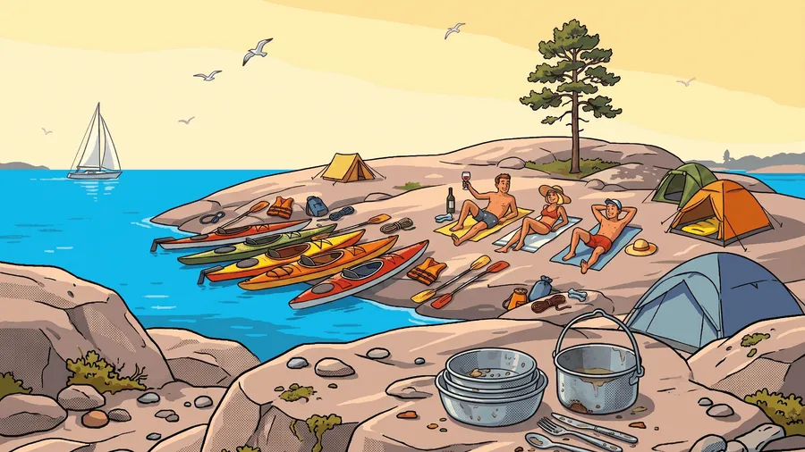
- The foundation — allemansrätten: a tent for 1–2 nights on almost any uninhabited island. A kayak goes where no boat can — you have the widest choice of camping spots of all “water-borne” travellers.
- How to choose an island: the lee side (lä), gently sloping rock slabs for landing, a flat patch of moss/grass or a hammock between pines. Smooth slabs + evening granite warmth = the country’s best “outdoor kitchens”. In the nesting season (April–July), avoid islets with bird colonies, even without a formal ban.
- Kayak at night — fully on shore: pull it above the waterline, tie it to a rock/tree and weigh down the cockpit — night wind and ferry wakes carry boats away regularly.
- Equipped campsites: in Skärgårdsstiftelsen areas (the foundation owns ~12% of the Stockholm archipelago) — fire pits, dry toilets, sopmaja for rubbish, wells in places; everything is free. Locations — on Naturkartan and Hamnkartan. Wind shelters — vindskyddskartan.se.
- Island cabins — you can book them: the “paddle all day → bed and sauna” combo works brilliantly. Options: Skärgårdsstiftelsen cabins (Gålö, Fjärdlång, Utö), island hostels by STF (Möja, Gällnö, Finnhamn, Grinda, Utö — swedishtouristassociation.com), private cabins via aggregators (see the Stockholm guide). Book summer stays well in advance. If you use STF hostels for 3–4 nights, membership (~375 SEK/year) pays for itself: ~100 SEK discount per bunk-night, plus 10–15% off SJ trains and partners and 15% off maps at Kartbutiken — useful for Calazo maps.
- Campsites on islands and the coast — a shower, kitchen and electricity every 2–3 days of the route: camping.se.
Water and Food on the Route
- Tip: the Baltic is slightly salty (~0.5–0.7% vs 3.5% in the ocean) — sea water in the skerries is just right for cooking: pasta, potatoes and porridge come out “pre-salted”. You cannot drink it, but it cuts your fresh water needs by half. This does not work on the west coast — the water there is genuinely salty, dilute 50/50 with fresh water or cook with fresh water only.
- But: algblomning (blue-green algae blooms) cancels this trick. In July–August the Baltic regularly blooms (a murky green “paint” and flakes on the water). Cyanotoxins are not destroyed by boiling (Livsmedelsverket) — during a bloom do not cook with sea water at all, swimming is questionable, keep children and dogs away from the water. Current situation: SMHI satellite maps (updated daily in summer) and the Länsstyrelsen observation map.
- Fresh water calculation: 3–4 litres per person per day (drinking + coffee). The forum consensus for long trips: two 5-litre containers in the hatches near the bulkheads + a bottle on deck; in the heat, wait out the hottest 2–3 hours in the shade — you sweat less, you carry less water.
- Where to refill:
- Guest harbours (gästhamn) — a hose or tap on the dock is almost always available: ~450 harbours across the country in Gästhamnsguiden (website + app); water points are also visible in Hamnkartan.
- Wells and pumps on Skärgårdsstiftelsen islands and near island villages — marked on Naturkartan (category dricksvatten); well water is formally “ej dricksvatten” after a dry summer — boil or filter it.
- Shops, cafés and hostels on inhabited islands (Möja, Sandhamn, Utö, Nämdö, Koster) — they will fill your bottles without question, plus you get ice cream and a weather update.
- Asking locals is normal: knocking on a door by a jetty with a water container — a completely normal archipelago practice, you will not be refused. Don’t be shy.
- Tip: extract all the water points for your area from OpenStreetMap via overpass-turbo. In OSM, water is tagged as
amenity=drinking_water(taps and drinking points),man_made=water_well(wells) andman_made=water_tap. On overpass-turbo.eu, centre the map on your route area, in the Wizard typeamenity=drinking_water or man_made=water_well→ Run — and you get all the points at once; export to GPX/GeoJSON goes straight into your navigation app. Coverage depends on volunteer mappers — this supplements Naturkartan and Gästhamnsguiden, not replaces them; a well you find on the spot can be added to OSM yourself.
- Food:
- Shopping — from land: shops only exist on the larger islands and have short opening hours — buy your main supplies before you start. Fresh food — for the first 24 hours, after that dehydrated/tinned; no glass.
- Stove gas — buy locally (you cannot fly with it). The Swedish standard is threaded EN417 canisters (skruvgas, for Primus/MSR/Optimus); puncture and clip-on Campingaz are less common — if your stove uses them, bring an adapter.
- Where to buy gas: outdoor and hardware chains are in every town — Naturkompaniet, XXL, Biltema (butane — only for warm temperatures), Jula (propane-butane mix, cheap), Clas Ohlson; plus petrol stations. Already on your route — campsites and kayak centres (canisters are usually in the shop at reception).
- Supermarkets (ICA Maxi, Stora Coop) — only a fallback: threaded canisters in the outdoors/grill section are seasonal and not in every store (Utsidan experience: “larger Coop stores may have them”); and the gasolautomat outside ICA Maxi is for large 5/10 kg propane cylinders for barbecues, not EN417.
- Alcohol-fuelled Trangia: fuel is even more available — denatured alcohol T-röd is sold at every petrol station, grocery and hardware store.
- Don’t rough it: unlike hiking, a kayak carries noticeably more than a backpack — fresh vegetables, good coffee and a bottle of wine for sunset on a granite slab travel happily in the hatch (The Kayak Trail guides’ philosophy).
- Plan your alcohol before you leave: everything stronger than 3.5% is only sold at Systembolaget — weekdays usually until 7 pm, Saturdays until 3 pm, closed on Sundays and public holidays, and there are none on the islands.
- Berries and mushrooms — a free allemansrätten bonus: on wooded islands, blueberries from mid-July, lingonberries and mushrooms in August; you can pick freely. Season and yield by area — svampkarta.se (historical finds) and svampindex.se (rain-based forecast).
Kayaking + Hiking
Sea kayaking combines well with hiking days — both as a “rest day” for the back and as a way to see the islands from the inside:
- Stockholm archipelago: Stockholm Archipelago Trail — a path across 21 islands (Arholma–Landsort); many stages are perfectly covered by kayak instead of a ferry: you arrive by water, walk a stage on foot, paddle on. Trails exist on Utö, Grinda, Finnhamn, Möja, Nämdö.
- Höga Kusten: the combo “paddle along the Skuleskogen cliffs + climb Skuleberget” — the region’s two best views in one weekend.
- Kosterhavet: on the Koster islands — a network of trails and cycling routes, you can park your kayak in any bay.
- Trail planning — Naturkartan; details on hiking — the guide Hiking & Winter Touring in Sweden.
With Children and for Beginners: Sheltered Bays
Deep enclosed bays and inner skerries behave more like lakes: the waves have no room to build, the wind is cut by the shores, you are always close to land — while the water is still technically “sea”. These are the best waters for first outings, children and SUP: the inner Stockholm archipelago, the waters behind Tjörn/Orust, the inner skerries of Gryt/St Anna, the long bays of Höga Kusten.
- What age: from ~2–3 years — as a passenger in the front cockpit of a double, but an adult in a single kayak must stay nearby, able to come alongside (the rear paddler of a double cannot reach the front cockpit); in the “midsection hatch” (mittbrunn) of large doubles you can fit 1–2 children; their own boat — from ~7–8 years for short crossings, a solo leg in a group — from ~10–12. Kajak & Uteliv guide
- Adult rules, child-sized breaks: a child-sized life jacket, always fastened; clothing matched to the water temperature; legs of 5–10 km with landings for a swim every hour to hour and a half. Plan the route “from island to island”, not by distance.
- Rental: children’s life jackets and paddles are not at every rental centre — ask when booking; the family classic is a stable double or an inflatable kayak (Stockholmkajak tips).
- Organised: Friluftsfrämjandet tours are graded 1–5 — the first levels run in sheltered waters and suit families (see the section on organised tours).
Safety and Rescue
The sea forgives less than a lake, but the large archipelagos are the most “forgiving” marine environment in the world — if you use their geometry:
- Wind is the main planning factor. The big-archipelago rule: you can almost always plan a route that hides from wind and waves — go into the inner skerries, under lee (lä) shores, into island mazes; cross open stretches (fjärd) in the morning before the daytime sea breeze kicks in. Plan a “plan B” for every day: the same campsite, but by a sheltered route. Benchmarks: 5–7 m/s — a comfortable limit for a beginner on sheltered water; 8+ m/s — do not cross open stretches; 10+ — a day on shore. For scale: even a strong experienced paddler cannot make headway against 16–17 m/s (Utsidan discussion).
- Standing waves and clapotis in the skerries are not that rare. Granite shores are steep and barely absorb waves — the wave bounces back and combines with the incoming one into a chaotic standing chop (clapotis): jumbled peaks with no rhythm, locally nearly double the height. Typical spots: along windward cliff faces and breakwaters, over underwater shoals (grynna), at the throat of channels with wind against current and where ferry wash meets wind waves near a shipping lane. What to do: do not hug the cliff on the windward side — move out 50–100 m or go under a gently sloping shore; in the chop itself — relaxed hips, short fast strokes (paddle in the water = support) and do not stop. It looks scarier than it is, but for beginners it is a common cause of capsize right near the shore — plan such sections as “narrow points” on a par with open crossings.
- Underwater boulders and shoals (grynna) are not always readable from the water. Glacial terrain is treacherous: granite boulders and shoals rise vertically from the deep, with no gradual approach — the depth can change from 10 m to 0.3 m within one boat length. In calm weather there is no breaker above the rock, dark granite is invisible against glare and in the dark Baltic water, and in waves the rock gives itself away with a sudden breaker (bränning) — the wave over the shoal rises and breaks without warning. And sjökort charts do not show all rocks: soundings were made for ship channels, and kayak shallows near shores are mapped crudely (plus low water and landhöjning — see the section on Baltic water levels). Practice: polarised sunglasses noticeably improve reading the water; near unfamiliar shores and in narrows, slow down; in shallows, raise the rudder/skeg (the most common breakage of a rental boat); in waves, give marked shoals a wide berth, even if they are quiet right now. A plastic kayak forgives a touch, but hitting a rock beam-on to the waves — a guaranteed capsize.
- The forecast is a hypothesis, not a promise. Models calculate wind over open water, but skerries distort it systematically: channels act like a nozzle and accelerate the wind beyond the forecast, high islands produce either dead calms or ragged gusts around the corner. The forecast number is the mean wind; gusts (byvind) are typically 1.5 times higher, and that is what you will actually be paddling in — check both numbers. The summer daytime sea breeze (sjöbris) adds 3–5 m/s to morning calm and is often understated in models — yet another reason to cross open stretches in the morning. The reliable forecast horizon is 1–2 days; anything further out is a scenario for planning rest days, not a promise. Practice: compare SMHI with the models in Windy (ECMWF vs GFS) — if the models disagree = trust neither and take the worst case; in the morning, check the forecast against reality at the nearest SMHI observation station; and keep a sheltered plan B for every day (see the first point) — that is your main insurance against a forecast error.
- Daily distance with a margin: experienced sea kayakers on multi-day trips often cover just 10–20 km/day — and that is normal: a headwind halves your speed, and a reserve of energy = a reserve of safety. Plan legs with a margin and factor in a rest day for stormy weather.
- Cold water — killer #1: outside July–August, dress for the water temperature, not the air (wetsuit or dry suit). In a capsize at +10°C, your hands stop working within minutes.
- Thunderstorms: a kayaker is the highest point on an open stretch. If you see a thunderstorm front in the forecast (åskväder on SMHI) or on the horizon — leave open water early and wait it out on shore, not under a lone tree. In the Stockholm archipelago thunderstorms are rare; on the west coast and in the south of the country — noticeably more frequent.
- Fog (dimma): the main season is spring and early summer, when warm air moves over still-cold water (advection fog can blanket you in minutes even on a sunny day), plus quiet autumn mornings. Rules: before entering a fog bank, take a compass bearing to the nearest shore and hold it; follow the shoreline, not across an open stretch; crossing shipping lanes in fog is out of the question — a ship is unlikely to see you on radar (a kayak gives almost no echo); keep the group tight, in voice contact, whistle ready; listen — in fog you hear an engine before you see it. GPS on your phone is a backup, but you steer by the deck compass — a screen is useless in drizzle. Visibility forecast (sikt) is in the sea forecast from SMHI and in Windy (Visibility layer).
- Don’t paddle alone further than you are willing to swim. In a group, stay within voice-call distance. Know self-rescue and partner rescue (kamraträddning) — any basic course teaches this; spray skirt, pump and paddle float with you at all times.
- Visibility: a bright boat/jacket, reflective tape on the paddle and life jacket; near shipping lanes — see the section on ferries. Summary of tips: SSRS — paddla säkert.
- How to call for rescue: the single number 112 — ask for sjöräddning (the sea rescue service, coordinated by JRCC); the SOS Alarm app transmits your position automatically. On the water, the work is done by volunteers from Sjöräddningssällskapet (SSRS) — fast boats along the whole coast; membership (~1,000 SEK/year) gives you free help even in non-critical situations. If you have a VHF radio — channel 16. Keep your communication devices on your body, not in the boat: phone in a waterproof pouch in your life jacket pocket or on a lanyard under the spray skirt, VHF/PLB/inReach — clipped to the life jacket. A useful extra option — a pyrotechnic flare (handbloss): burns bright red for ~60 seconds and works even when wet — you can light it with wet hands and it does not go out in spray or rain; at night it is visible for kilometres, in daytime pair it with a smoke signal (röksignal). It depends neither on batteries nor on network coverage — the last reserve when your electronics have drowned or run flat. Sold without a licence in boat shops (Hjertmans, SeaSea and others), its place is in a life jacket pocket; watch the expiry date (usually 3–4 years; expired flares are handed back to the seller or to the police) — and only set it off in a real emergency: a flare is legally equal to a Mayday signal.
- Satellite communication for the outer skerries and the north: where the mobile network has gaps, take a two-way satellite messenger (Garmin inReach) or a nödsändare PLB — a personal locator beacon with free registration at Sjöfartsverket, the signal goes directly to the JRCC rescue centre. No need to buy: inReach rental — Satellite SOS from ~19 SEK/day, PLBs and inReach from private owners — Hygglo ~100 SEK/day.
- Mark your kayak: a sticker/marker with your name and phone number inside the cockpit. An empty kayak found without markings automatically triggers a full-scale search operation — “Den här är min” sticker from SSRS.
- Route plan — leave one with someone on shore (area, camping spots, check-in time). Mobile coverage in the archipelagos is generally good, on the outer skerries — there are gaps; keep a power bank in a dry bag, your phone — on your body (see above). Check coverage before you start using your operator’s map — not “in general”, but by the specific points on your route and campsites: Telia (best coverage in the country according to Opensignal), Tele2, Telenor, Tre; the map shows predicted outdoor coverage, not a guarantee of service.
- Insurance: rescue itself in Sweden is free for everyone — neither SSRS nor JRCC send bills. But medical treatment is not free: EU citizens need an EHIC card, everyone else — travel insurance (reseförsäkring) that covers water activities. Damage to a rental kayak is on the renter by default — check the terms when booking; Hygglo includes insurance, and for Swedish residents, liability is often covered by drulleförsäkring within their home insurance (hemförsäkring).
- Minor risks: slippery wet rocks (the most common injury is when getting out of the boat), ticks on islands (TBE — see the Stockholm guide), sun with reflection off the water — you burn twice as fast. On the west coast in late summer — stinging lion’s mane jellyfish (brännmanet): the sting is painful, though not dangerous; wash with sea (not fresh!) water and remove tentacles with the edge of a card, not your hand.
Incident Chronicle (2016–2026)
A selection of real accidents from the last 10 years drawn from news archives. Geography matters, and the takeaway is counterintuitive: fatal cases cluster on large open waters — the open stretches of Vänern, the exposed coast of Halland, the Gulf of Bothnia. In sheltered skerry mazes, incidents usually end with a search operation, not a fatality — the archipelago’s geometry really does “forgive” (see the safety section).
Vänern and the Large Lakes
- July 2022, the stretch between Djurö and Lurö — two men ~20 years old died on a planned multi-day trip; the police assessed them as “ovana paddlare” (inexperienced). Kayaks, paddles and gear were found scattered over a radius of ~5 km. Likely cause — capsize on an open stretch: according to press reports, the inexperienced paddlers were caught by a sudden worsening of the weather (Aftonbladet). Lesson: crossing an open stretch on Vänern is a sea stage, not a lake outing. Aftonbladet, NLT
- 2023, Västsverige — a series in one week: a woman found dead next to her kayak (cause — drowning after capsizing; the police did not publish details), more paddlers were taken off the water on Vänern. Swedish Radio breakdown on the minimum requirements for going out on the water: Efter kajakolyckorna
- Hammarö, northern Vänern (an old case — outside the 10-year window, but a textbook example) — an experienced sportsman capsized on a 2 km crossing in cold spring weather; his partner did everything possible, but the person died of hypothermia. Björn Thomasson’s classic analysis of why in cold water only a roll and a dry suit save you: Tragisk olycka
Gulf of Bothnia and Norrland
- August 2018, Luleå skärgård — a 65-year-old paddler, experienced, capsized between Junkön and Kälkholmen and drowned; he was alone. Experience does not repeal the rule “don’t paddle alone further than you are willing to swim”. Norran, NSD
- Hörnebukten near Hudiksvall — a man ~60 years old found dead after a report of an overturned empty kayak. Cause — capsize and drowning; he was alone, why he capsized — unknown. Sveriges Radio
West Coast (Halland / Bohuslän)
- June 2016, Varberg–Falkenberg — a multi-day search for a missing kayaker along the exposed Halland coast ended with a body found at sea. Cause not officially published — drowning on open water; the Halland coast has no skerry shelter from waves. Sveriges Radio
- Skallahamn, Onsala peninsula — a man ~35 years old died after capsizing not far from shore; he was pulled from the water by a passing boat, but could not be saved. Why the kayak capsized — never established (SR). SVT Halland
- June 2024 and April 2026, Åsa — two search launches for “missing” kayakers (in 2024 even the Danish rescue service was called in); both times the people were found alive — the cause of the alarms was not an accident but loss of orientation and no means of communication (a delay with no warning). SR, Kungsbacka-Posten
- Hafsten (Uddevalla) — two people in a kayak were listed as missing, found by a sea rescue boat; cause — the same delay without communication, not an accident. SR
Stockholm and Mälaren
- July 2025, Mälaren (Bromma) — an empty kayak found: a large search with aircraft (SSRS, Coast Guard, Sjöfartsverket), a missing person declared — a rental kayak returned without the paddler; cause unknown, the police do not suspect a crime. Lesson: an empty boat without markings automatically triggers a full-scale operation — a sticker with a phone number saves the rescuers hours. Sveriges Radio
- July 2026, Husarö–Möja — two people fell behind from a large group; helicopters and boats searched until the evening, found them on an island between Svartlöga and Lidö: they “just paddled to the wrong island” and made contact by phone. Lesson: in a maze of 30,000 islands, a navigation error is a matter of time; in a group, agree on rendezvous points, keep your phone charged and accessible. Omni
Rivers and Canals (Rental Canoes)
- August 2025, Kolbäcksån / Strömsholms kanal — a man ~60 years old capsized and drowned at the Hallstahammar hydropower station; the rental operator says bluntly: “capsizing there is deadly dangerous”. After the incident, the power station owner initiated stronger signage and markings. Lesson: dams, spillways and the pull at power stations — always a portage zone, no exceptions. SVT, follow-up
⚠️ Patterns. 1) People die on open water, get lost — in the skerries; build your route around sheltered geometry. 2) The typical fatal profile — a solo paddler aged 60+, which matches the SLS drowning statistics (in total ~90–106 people drown in Sweden each year across all activities, older men are overrepresented; paddling is a small share). 3) Cold water is the main killer according to Kanotförbundet: dress for the water temperature. 4) Lack of experience on large open water (Vänern 2022) is more lethal than at sea in the skerries. 5) “Missing” people are almost always found alive if they have a phone and a route plan on shore. Report your own incidents and “near-misses” to the Kanotförbundet anonymous reporting system — that way statistics turn into prevention.
Paddling in a Group: Club Rules
Swedish kayak clubs have been refining group trip rules for decades — their säkerhetspolicy is useful for any independent group (example — Tjörns Kajakklubb):
- Distance — “whistle radius”: everyone stays within hearing range of a whistle (the whistle itself on the life jacket is standard equipment). If you want to leave the group — tell someone.
- Before crossing an open stretch or shipping lane, the group gathers into a tight formation; the most experienced paddler goes on the windward side (lovart) with a view of the whole group.
- Mandatory personal minimum for any outing, even a short one: spray skirt, clothing suited to the season, a warm dry change in a dry bag, drinking water, a first-aid kit and personal medication. First-aid kit guide (in a dry bag): bandages and plasters — wet rocks and shells cut; painkillers; antihistamine; tick tweezers/remover; sunscreen and burn cream; blister plasters for your palms (the first long days). The organiser has the right to not take on an under-equipped participant.
- Life jackets are worn, not carried: a fastened life jacket on everyone at all times on the water; a life jacket lying on deck reduces the safety of the whole group, not just the owner.
- Everyone is responsible for themselves: club trips are kamratpaddling (companion paddling), not a commercial guided service; having an “organiser” does not remove personal responsibility.
- Kamraträddning — a group skill: if you don’t have it — tell the organiser in advance, clubs teach it willingly. Club trips are graded by difficulty (example grading from Örnsbergs Kanotsällskap): above the basic level, the entry requirement is competence in self-rescue/kamraträddning and confident paddling in moderate waves.
The Swedish Canoe Federation’s safety handbook for clubs: Säkerhetshandledning (PDF).
Organised Tours and Training
If you don’t want to plan everything yourself or don’t have a partner — there is ready-made infrastructure:
- Friluftsfrämjandet — a non-profit with trained leaders: group kayak tours from evening outings to multi-day trips with overnight stays, a unified difficulty grading from 1 to 5 (by km/day and how open the water is). Participation is open to non-members too (slightly more expensive), equipment is usually included. Find: Hitta äventyr → filter Vatten & paddling → Kajak.
- Commercial guided tours and courses — at all the major centres: Skärgårdsidyllen (Bohuslän, including tours in Kosterhavet National Park), Kajaktiv Tjörn, dozens of operators in Stockholm. A guided weekend ~2,000–4,000 SEK with equipment and food.
- Kayak clubs (kajakklubb / kanotsällskap) — in every coastal town: cheap courses, joint trips, winter Eskimo roll practice in swimming pools. List of clubs — kanot.com.
- Online communities — fresh trip reports, trip partners and quick answers to any question (in addition to the Utsidan forum — see “Useful Links”):
- Facebook: Kajak Sverige — a national group about everything kayaking; Kajakpaddling i Stockholm — “club-free” Stockholm paddlers, joint outings; Vi som gillar att paddla i sjöar och hav — relaxed paddling on lakes and at sea; Hopfällbara och uppblåsbara kajaker — folding and inflatable boats. Look for regional groups by searching “paddling/kajak + town” — there are groups for Gothenburg, Vaxholm and most coastal towns.
- YouTube in Swedish: Escape Outdoors (Gothenburg) — the best Swedish breakdown of safety and self-rescue in sea kayaking (launching/landing, paddle-float rescue, winter paddling); LEK MER | Kajak & SUP (Stockholm) — technique and urban routes like “Kungsholmen runt”; All Seasons Kayaking — 250+ videos of year-round tours in Sweden, gear reviews and Greenland paddles.
- Podcasts: Kajakpodden — Swedish conversations about paddling, nature and life by the water; Kanotpodden — interviews with legends of Swedish paddling; the Norwegian Kajakkpodden is understandable if you know Swedish; internationally — Paddling The Blue about sea kayaking worldwide.
- Blogs: a collection of live threads and blogs from the Utsidan editorial team — Paddla i sommar; trip reports from Bohuslän — kajakrapporten.se.
- First time at sea? The best way in: a basic course (1 day) → a couple of tours with Friluftsfrämjandet → a self-supported two-day trip in sheltered skerries (Sankt Anna or the inner Stockholm archipelago).
What Else to Know
- There are almost no mosquitoes on the outer skerries — the wind blows them away; this is a noticeable bonus compared to forest river trips. Ticks do exist on grassy islands.
- Wildlife is part of the experience. A kayak is silent — you see more wildlife from it than from any other boat. What to expect:
- Seals — two species: grey seal (gråsäl) in the Baltic, harbour seal (knubbsäl) on the west coast. They are curious and often swim up to look at the kayak — stop and let them choose the distance themselves, do not chase them and stay away from haul-out sites (see sälskyddsområde in the first section).
- Porpoises (tumlare) — on the west coast (Kullaberg, Koster) the chance is real: a short black fin, they never jump like dolphins.
- Skerry birds: white-tailed eagle (havsörn) — an almost guaranteed sighting, its wingspan of up to 2.4 m is unmistakable; eiders (ejder) in spring form “nurseries” — broods of several females together; terns (tärnor) dive at your head near a nesting islet — this is a signal to move away immediately; a mute swan with cygnets is capable of attacking a kayak — give broods a wide berth; cormorant (skarv) colonies — whitened islands with dead trees, pass on the windward side (the smell). The general rule for spring and early summer: a bird acting injured and leading you away means you are already too close to the nest.
- Animals on islands and in the water: moose and roe deer are excellent swimmers and routinely cross channels — a swimming moose is not exotic; on the water do not approach and do not cut off the path to shore. On large wooded islands roe deer are almost tame; at night by the tent hedgehogs and mink rustle — put food away in the hatch at night. There are no bears or wolves in the skerries.
- When moving between waters, rinse your boat and gear — the Swedish Canoe Federation’s request to prevent the spread of invasive species (kanot.com).
- A dog on board — it’s normal: the spot is on the bottom of a double’s cockpit or in the middle hatch (mittbrunn), train the dog to lie down on land beforehand; a dog life jacket (hundflytväst) with a handle on the back is a must — you pull the dog out of the water by it. In nature, a lead is mandatory from 1 March to 20 August (protection of wild young), and in fågelskyddsområde the rule is even stricter with a dog — keep double the distance. Carry fresh water for the dog separately: it cannot drink sea water, and during algblomning the toxins are dangerous to dogs first of all.
- The archipelago is a community: conversations with other kayakers, boaters and islanders — a working source of local knowledge (campsites, weather, where to find water) and half the atmosphere; don’t pass people by — sometimes it ends in a shared dinner (The Kayak Trail guides’ tip).
- Payment: as everywhere — card only; Swish signs are useless to a tourist (you need a Swedish bank account).
- Tides are virtually absent (Baltic — 0, west coast ~30 cm), but wind-driven water level changes move the level by tens of centimetres — another reason to pull your kayak well up.
- Baltic water level wanders not just by the hour, but by the month. The sea has only one narrow “door” — the Øresund and the Belts, and the level is set by the weather regime, not by rivers: westerly winds and cyclones push North Sea water in (up to +0.5…1 m), a stable high-pressure system with easterly winds pushes it out — and until the blocking high moves on, the sea stands 30–70 cm below normal for weeks and months. Example: in winter 2026, over the course of a month ~300 km³ drained out (two Vänerns), Stockholm hit −69 cm — the lowest since 1972 (SVT, SMHI breakdown). Seasonal rhythm: the minimum is usually in spring (stable high-pressure over Scandinavia), the maximum — in winter with westerly gales (SMHI kunskapsbanken). Plus a century-scale background: land uplift (landhöjning, up to ~9 mm/year in the Gulf of Bothnia) slowly makes the northern skerries shallower than on old maps. For a kayaker, low water = shallow passages in the sjökort don’t exist, landings on rock slabs are further out and muddier; current and forecast water level — Vattenstånd och vågor at SMHI.
- Channels get overgrown. Narrow, shallow sund between islands get choked with reeds (vass) and algae by mid to late summer — a “channel” on the map may turn out to be a green carpet, especially in the inner skerries and during low water. Through thin reeds a kayak can push, thick reeds + shallows = portage. When planning a route through narrows: check depths on sjökort (Eniro), satellite imagery (flygfoto in Eniro / Google) — growths are visible on it, and keep a spare bypass channel.
- Races and events for inspiration: week-long “skerry” expedition races and festivals are announced on kanot.com; in July harbours are busy and fun, in August — the ideal balance.
- In winter, the same water — long-distance skating (långfärdsskridskor) on inner bays: see the guide Practical Guide to Stockholm and Around.
Mini Dictionary
| Term | Meaning |
|---|---|
| havskajak / paddling | sea kayak / paddling |
| skär / kobbe | skerry / bare rocky islet |
| fjärd | open stretch between islands — the main “wind” sections of your route |
| sund | channel / narrow strait |
| lä / lovart | lee side / windward side |
| farled | shipping lane (cross at a right angle) |
| svall | wake from a vessel (hits the shore with a delay) |
| naturhamn / gästhamn | natural harbour / guest harbour with services |
| brygga | jetty, dock (private ones — only a short technical stop) |
| kapell | spray skirt |
| packlucka | cargo hatch |
| roder / skädda | rudder / skeg |
| flytväst / länspump / paddelflöte | life jacket / pump / paddle float |
| torrdräkt / våtdräkt | dry suit / wetsuit |
| tillträdesförbud / landstigning förbjuden | access ban / landing prohibited |
| fågelskyddsområde / sälskyddsområde | bird / seal protection zone (seasonal ban) |
| skjutfält / avlyst / skyddsobjekt | military firing range / closed (during live firing) / protected object (no landing, no photography) |
| sjökort / grynna | nautical chart / underwater rock-shoal |
| dricksvatten / brunn | drinking water / well (ej dricksvatten — not for drinking) |
| sopmaja / dass | rubbish hut (Skärgårdsstiftelsen) / dry toilet |
| vindskydd / eldplats | wind shelter / fire pit |
| eldningsförbud | fire ban (in dry weather) |
| uthyrning / kajakuthyrning | rentals / kayak rental |
| kanot / kanadensare | canoe (single-blade paddle, open hull) — in rental centres, kanot and kajak are always separate items; kanadensare — the standard for fell lakes |
| kanotled / kajakled | marked water route with infrastructure (Stockholms kajakled, ARK56) |
| kanotcentral | kayak/canoe centre: rental + transport + local information desk |
| hemfridszon | private zone around a home — do not land or camp (rule of thumb: out of sight and hearing of the house) |
| lägerplats / rastplats | equipped campsite / rest stop |
| tält / tältplats | tent / tent pitch |
| stuga | cottage — bookable cabins on islands (Skärgårdsstiftelsen, STF) |
| bastu | sauna — in guest harbours, hostels and on islands (the classic: a wood-fired sauna after a day of paddling) |
| badplats | official swimming spot |
| ved / vedförråd | firewood / woodshed at an equipped campsite |
| fiskekort | fishing licence: not needed on the sea coast (hand gear), almost always needed on lakes and rivers |
| fika / matsäck | coffee break with something sweet / packed food (thermos + sandwiches) — an essential part of any outing |
| ej / förbjudet | ”not / no” / “prohibited” on signs and maps: ej dricksvatten — water not for drinking, ej tillträde — no entry, landstigning förbjuden — landing prohibited, eldning förbjuden — fires prohibited |
| privat | ”private” on signs: privat brygga — private jetty, privat mark — private land; signals the boundary of a hemfridszon |
| avgift | fee, charge (hamnavgift — harbour fee, serviceavgift — service fee at a campsite) |
Useful Bits from Other Guides
- Practical Guide to Stockholm and Around: Waxholmsbolaget and water taxis, city kayak rental and prices, boat rental, campsites/hostels/cabins on the islands, car rental and parking, Fritidsbanken (free life jackets, tents, dry bags), ticks and nature risks, emergency numbers and pharmacies.
- Canoeing Rivers and Canals in Sweden: how kanot differs from kajak, the kanotcentral culture (“rental centre = your local information desk”), packing and making camp, paddling with children — most of the tips work at sea too.
- Hiking & Winter Touring in Sweden: allemansrätten in detail (the Bruna kortet test), the STF system, gear and where to get it, night trains to the north (Höga Kusten, Luleå).
Useful Links
| Link | Purpose |
|---|---|
| kartor.eniro.se | Free nautical charts (Sjökort layer) |
| naturkartan.se | Campsites, wind shelters, drinking water, routes — web and app |
| hamnkartan.se | Natural and guest harbours, water and services |
| gasthamnsguiden.se | ~450 guest harbours in Sweden (website + app) |
| skyddadnatur.naturvardsverket.se | Map of all protected areas, including bird/seal zones |
| forsvarsmakten.se — skjutfält | Military firing ranges: maps and firing schedules |
| sjoraddning.se | SSRS: safe paddling, membership, kayak marking |
| sosalarm.se | 112 app with automatic position transmission |
| smhi.se | Wind, waves, water temperature, warnings |
| windy.com | Compare wind models when planning |
| kanot.com | Swedish Canoe Federation: safety, courses, Godkänd Kanotcentral, clubs |
| utsidan.se | Sweden’s largest outdoor forum: paddling, kayak choice, routes and trip reports |
| kayakomat.com | 24/7 self-service rental lockers across the country |
| stockholmkayaktrail.se | Marked kayak trail through the Stockholm archipelago (~140 km) |
| ark56.se | Network of water and hiking routes in Blekinge |
| skargardsstiftelsen.se | Campsites, wells and cabin rental in the Stockholm archipelago |
| waxholmsbolaget.se | Island ferries — return from one-way routes |
| resrobot.se | Transport planner for the whole country |
| friluftsframjandet.se | Group kayak tours and courses nationwide |
| krisinformation.se — eldningsförbud | Current fire bans |