UnlockSweden
· Guides · 31 min read
Hiking & Winter Touring in Sweden
A practical guide to how hiking works in Sweden: the STF system of marked trails and huts, maps, transport, food supply, nature rules, and safety. It is based on hiking in the Swedish mountains (the Abisko area, Kebnekaise, and the Kungsleden trail), but the same ideas work all over the country, in summer and in winter.
Contents
- Allemansrätt and how to behave in nature
- Climate and seasons
- Maps and route planning
- What the trails and terrain are like
- Gear: local specifics
- Guides and group hikes
- The STF system: marked trails and huts
- Transport and logistics
- Communication and emergency contact
- Emergency: help, rescue, and insurance
- Money and payment
- Food and gas
- Hazards and safety
- Sarek: a self-supported wild zone
- Example area: Abisko and the northern Kungsleden
- Useful from other guides
- Useful links
Allemansrätt and how to behave in nature
The Swedish allemansrätten (“the right of public access”) lets you walk freely in nature, no matter who owns the land. You can pick berries and mushrooms (for seasons and areas, see svampkarta.se — a map of past finds by municipality — and svampindex.se — a forecast based on rain and forest type), swim (official swimming spots with water quality and temperature are on havochvatten.se), and sleep in a tent. Main limits:
- One or two nights in the same place; longer needs the owner’s permission. In the mountain tundra you can camp freely.
- Do not camp where houses can see you, and do not walk across fields or private plots.
- Dogs must be on a leash in nature from 1 March to 20 August (to protect young wild animals); in reindeer areas — always.
- Fishing in most waters needs a licence (fiskekort).
- Waste: carry out everything you bring. In STF fjällstugor (mountain huts) you may leave only clean, pressed, and sorted “storable” waste: metal, glass, hard plastic, batteries, empty gas canisters, and deposit bottles. Soft plastic, paper, freeze-dried food packaging, and food waste must be carried out to a normal collection point or a roadside fjällstation. Full rules: STF — waste handling in mountain huts.
- Toilet in nature: go far from water, trails, and campsites, dig a small hole, and cover it after. Do not leave toilet paper or wet wipes and do not hide them under a stone — carry them out in a zip bag. STF guide and test: Bruna kortet.
- Campfires: there is no fixed calendar ban — a fire is allowed when it is safe. But in dry periods a fire ban (eldningsförbud) is set; check the status on krisinformation.se or in the Brandrisk Ute app. Use prepared fire spots — map: grillplatser.nu.
Protected areas
- Nationalparker — national parks (sverigesnationalparker.se).
- Naturreservat — nature reserves; there are thousands, including most interesting hiking areas.
- Skyddsområde — a general name for a protected area; for hikers the most important are djur- och växtskyddsområde (areas that protect animals and plants): there can be seasonal or permanent bans on walking, landing on islands, boats, and dogs — usually to protect nesting birds or sensitive species. In these areas the rules are stricter than the general ones: fires often only in prepared spots, tents only in marked zones, and sometimes dogs are not allowed. The rules of each area are published on the county board (länsstyrelse) websites and on naturkartan.se — read them before you go.
Military training areas and shooting ranges (övnings- och skjutfält)
Sweden has many large military training areas, including in forests and mountains. When there is no shooting, part of the area may be open, but during live-fire exercises the whole area is closed.
- Do not count on a fence: the border often runs through forest with no full fence — only signs, notices, barriers, or warning devices. If you see
Skjutfält,Tillträdesförbud,Fara, or a red flag — turn back and do not go around the barrier. - Check before and on site: the areas are on the Lantmäteriet base maps, including Min Karta, but the line on the map is only approximate — the signs and real barriers on the ground decide. Closing days and hours are published by Försvarsmakten; the schedule can change at short notice.
- Consequences and safety: breaking an entry ban can lead to a large fine; entering a marked
skyddsobjektcan mean up to two years in prison. The main risk is ammunition and shooting: do not touch anything you find, and if you suspect ammunition, move away, warn others, and call 112.
Climate and seasons
Sweden stretches almost 1,600 km from south to north, so there is no single “season”: the south (Skåne, ~55°N) and the Arctic mountains (Abisko, ~68°N) live by different calendars.
- High summer season in the mountains (fjällen): late June to mid-September. STF huts with staff are open roughly from Midsummer to mid/late September.
- Early summer (late June – early July): there is still snow in the mountains, and rivers are high — river crossings are hardest at this time.
- Insects: mosquitoes and blackflies peak in Norrland from late June to July. The best balance of good weather and few insects is late August – September: golden autumn, few people, night frosts in the mountains.
- South and central Sweden (Sörmland, Skåne, Höga Kusten): a comfortable season from April–May to October; forest trails are walkable almost all year.
- Ski season in the mountains: late February – early May (the STF winter season). December–January is dark and cold; north of the Arctic Circle December has polar night.
- Daylight: Stockholm (~59°N) — about 18.5 hours in late June and ~6 hours in late December; in Abisko there is polar day from late May to mid-July. The Swedish mountains lie in the rain shadow of the Scandinavian range, on the eastern, continental side: less rain, and calmer, more predictable weather. You can plan a route in advance; just add one spare day in case of bad weather in the mountains.
- Weather forecast: smhi.se — the official Swedish weather service; mountain forecasts and storm warnings (yellow/orange/red levels). yr.no also covers Sweden well.
- Avalanches: lavinprognoser.se — winter forecasts for the main mountain areas.
Maps and route planning
Swedish topographic maps are accurate and free:
| Resource | What it gives |
|---|---|
| minkarta.lantmateriet.se | Official state topo map (Lantmäteriet); there is a Min Karta app |
| Kartsök och ortnamn | Same Lantmäteriet: manual route planning and easy map printing |
| ain-outdoor.com | Route planner with auto-routing on the Swedish base map |
| naturkartan.se | A catalogue of trails, reserves, campsites, and wind shelters across the country on the Lantmäteriet base map; GPX tracks; mobile app |
| svenskaturistforeningen.se | STF portal: huts, mountain stations, routes, booking |
| resrobot.se | One planner for public transport across the country |
Good to know:
- Trails on the state map usually exist in reality, but small forest trails off the marked routes get overgrown and hard to follow — a GPS track and an offline map are a must.
- For the mountains Lantmäteriet makes a special Fjällkartan series — it is also the base for Min Karta and Naturkartan.
- On marked mountain routes big rivers have bridges; small streams are crossed by wading or on stones. In early summer and after rain the water is high.
- For offline navigation you can use Min Karta, Naturkartan, AlpineQuest (it supports the Swedish Lantmäteriet layers and lets you download maps in advance), and other third-party apps with the Swedish base map.
- Detailed maps for orienteering (coverage is patchy, but common in popular forests near towns) — at omaps.net/se.
Paper maps and guidebooks
A paper map is a must-have backup for navigation in the mountains. The standard is 1:100,000 for long routes and overview, and 1:50,000 for detail.
- Calazo — the leading outdoor publisher in Scandinavia: fjällkartor and terrängkartor on waterproof, almost indestructible Tyvek. 11 double-sided 1:100,000 sheets cover the whole mountain chain from Sälen to Treriksröset, and popular areas also come in 1:50,000. They also make guidebooks for hiking, skiing, and paddling.
- Kartbutiken (a shop in Stockholm + online store) — the widest choice of maps and guides for Sweden, including the classic Fjällkartan 1:100,000 series (25 sheets based on Lantmäteriet). STF members get 15% off the normal range (the code is in your STF account).
- Outdoor shops: Naturkompaniet, Widforss, and shops at fjällstation keep maps of their own area — easy to buy on site, but the sheet you need may not be there.
- Print your own map: any part of the base map can be prepared and printed through Kartsök och ortnamn (link in the table above) — a free option for short routes.
- An overview of the current mountain map series is at Fjällsäkerhetsrådet.
What the trails and terrain are like
- Swedish mountains usually have gentle terrain: rounded massifs, wide valleys, flat tundra plateaus. The height you climb in a day is usually small, but the distances between shelters are longer.
- A typical feature is bogs and wet tundra: on the worst parts of marked trails there are wooden boardwalks (spänger). Off the boardwalks be ready for wet feet even in dry weather.
- The mountain birch forest belt (fjällbjörkskog) is hard to walk without trails — thick and bumpy; above the tree line walking off-trail is comfortable.
- South and central Sweden — forest trails over rock slabs (hällmark), roots, and bogs with boardwalks; the terrain is broken but the height changes are small.
- Tent spots are easy to find: wide valleys, dry tundra terraces, lake shores. On open plateaus there is wind and rock instead of soil — use guy lines held down by stones. Many areas are boggy, so look for tent spots on higher ground.
Gear: local specifics
A standard set for self-supported hikes, with some changes:
- Footwear: trekking boots with gaiters, or fast-drying trail shoes if you accept wet feet. Spare dry socks are a must.
- Trekking poles: strongly recommended — river crossings, boardwalks, boulder fields.
- Head net and repellent: needed in Norrland in late June – July.
- Tent: wind-resistant for open tundra; a free-standing design is handy on rock.
- Sleeping bag: in summer a comfort of about 0…+5 °C; from late August in the mountains a below-zero comfort.
- Clothing: a full membrane top and bottom, and a warm layer even in summer.
- Electronics: a power bank with spare charge — STF mountain huts usually have no electricity for guests.
Gear rental
- Fritidsbanken: free rental of sports and outdoor gear for up to 14 days; the range depends on the branch (tents, sleeping bags, backpacks, skis, snowshoes, kids’ gear). The items are second-hand and their condition is unpredictable — good for an easy trip, not for a self-supported or technical route. Check the stock and the nearest branch in advance and inspect every item.
- Hygglo: rental from private people, handy for a summer or winter set in cities; search for
tält,vandringsryggsäck,turskidor,längdskidor,snöskor,pulka. Check the deposit, insurance, condition, and the exact pickup place/time: Hygglo. - Summer — rental at STF fjällstation: stations rent tents, sleeping bags, backpacks, footwear, poles, rain clothing, and stoves — not only Abisko and Kebnekaise, but also STF Saltoluokta and STF Grövelsjön. In Abisko you can take part of the set for the walk to Nikkaluokta and return it there. Check the range and dates on the station’s page.
- Winter — skis and safety: Abisko — skis, snowshoes, avalanche gear, tour skates; STF Storulvån — in winter a full set for ski touring and cross-country skis; STF Grövelsjön — cross-country and touring skis, snowshoes, tent, stove; Kebnekaise — ski touring and mountaineering; Saltoluokta — mountain trips all year. Book skis, skins, the avalanche set, and a pulka in advance, especially during school holidays and the Easter season.
- Other local rentals: private shops near specific areas: in Åre — Outdoor Buddies (tents, sleeping bags, clothing, boots) and SkiStar Åre (alpine/cross-country skis, snowboard); in Grövelsjön — Fjällbua (outdoor goods) and Grövelfjäll (boats, canoes/kayaks, poles). In other areas search for
place + uthyrning,friluftsuthyrning,skiduthyrning,kanotuthyrning; check the terms with the operator. - Important: rental at a fjällstation is meant for the start and day trips, not to replace a full self-supported set deep on the route. Check the booking, boot sizes, return rules, and whether the avalanche set (transceiver, probe, shovel) is complete. Learn unfamiliar winter gear before you go into the mountains.
Guides and group hikes
A guide is useful for a first mountain route, a winter ski tour, a glacier, avalanche terrain, a summit climb, or a self-supported area.
- STF groups: multi-day and one-day programmes, plus local activities at the Storulvån and Kebnekaise stations.
- Local tour operators: look for programmes through regional tourism portals — for example Åre Sweden and Kiruna Lapland. There are day trips, ski tours, snowshoeing, summit climbs, and multi-day routes.
- Private guide: for technical tasks and a custom route use the list of certified SBO guides or contact Svenska Bergsguideorganisationen. Search terms:
guidad vandring,bergsguide,skidguide,lavinkurs, andarea name + guide. - Choosing the format: check the qualification, group size, language, level, included transfers/gear, and the weather cancellation terms in advance. For glaciers, mountaineering, off-piste skiing, and avalanche ski touring choose an SBO/IFMGA guide.
The STF system: marked trails and huts
STF (Svenska Turistföreningen) is the largest organisation that supports hiking infrastructure in the mountains: a network of huts and stations linked by marked trails, plus hostels across the country.
Huts
- Fjällstation (mountain station) — a serviced lodge: staff, a restaurant or kitchen, a shop, rental, rooms of different levels. Key points: Abisko, Kebnekaise, Saltoluokta, Grövelsjön, Storulvån, and others.
- Fjällstuga (mountain hut) — self-service with a warden (stugvärd): bunks, gas stoves, firewood, and in many a small food shop. Water is carried from a stream, and there is usually no electricity. Bedding is blankets and pillows; your own sheet or sleeping bag is required.
- Life is shared and simple: bedrooms for several people, snoring neighbours half a metre away, a queue for the stoves at dinner time, a drying room full of wet gear, and an outdoor toilet (utedass). Earplugs and a headlamp by your pillow clearly improve the night.
- Guest duties: bring water, chop firewood, and clean up before you leave; instructions are posted in every hut.
How it works
- Membership: ~375 SEK a year (prices change). It gives about a 100 SEK discount per bed-night in mountain huts and stations, plus 10–15% off SJ, Snälltåget, Norrtåg, and Vy-tåg trains (for SJ — when you book through the STF website at least 10 days before departure) and discounts on rental and with partners. DNT members (the Norwegian tourist association) get the STF member price in mountain huts and stations — and it works the other way too. In border areas you can easily combine huts from both countries on one route (for more on the Norwegian hut system, see the guide Hiking in South Norway).
- Booking: through the STF website; a pre-paid night is cheaper than paying on site (a guide value for Kungsleden in summer: ~470 SEK for members when pre-paid vs ~520 on site; non-members +100).
- Nobody is turned away: people who arrive without a booking will get a place — on the floor if needed.
- Tents and day guests also pay: camping in the mountains is free, but for access to the kitchen, drying room, shower, and other rooms at fjällstugor and fjällstation there is a service fee (serviceavgift) — both when you camp in a tent nearby and when you visit for the day without staying (cheaper for members). Current rates: STF — tält- och serviceavgift.
- Seasons: winter — late February to early May; summer — from Midsummer to mid/late September. Outside the season — only säkerhetsrum.
Marked trails
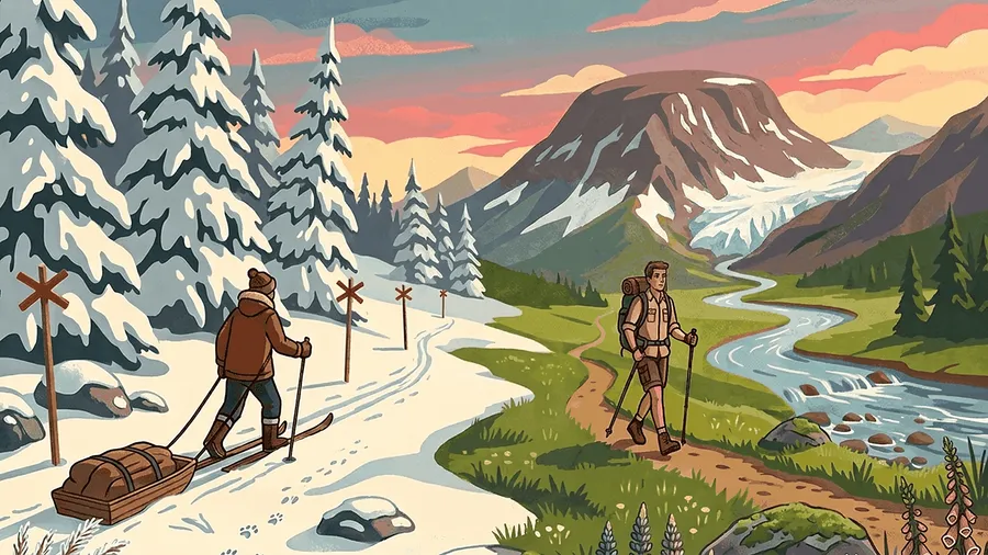
- Summer marking in the mountains is orange-red marks on stones, cairns, and signs; winter routes are marked with red crosses on poles and often go over lake ice — they are not for summer.
- The flagship is Kungsleden (~440 km, Abisko – Hemavan): on the northern part there are 16 STF huts every 10–20 km, so you can walk light.
- Popular routes are crowded: the northern Kungsleden (Abisko – Kebnekaise) and other flagship parts are heavily worn, and in high season (July–August) the trail and huts are full of hikers. For quiet, go to less-known parts or in September.
- Other big trails: Padjelantaleden, Jämtlandstriangeln (the popular “triangle” of stations Storulvån – Sylarna – Blåhammaren), Höga Kusten-leden.
- In the south there are dense networks of lowland trails: Sörmlandsleden (~1,000 km, reachable from Stockholm by city transport), Skåneleden, Roslagsleden. Along them are free wind shelters (vindskydd) with fire spots — you can see them on naturkartan.se and on the special shelter map vindskyddskartan.se.
- Time estimate: on tundra and bogs with a backpack a realistic pace is 2–3.5 km/h.
- In winter there is no “trail” under your feet, but wind-packed snow, sometimes hard or icy. The tracks of allowed snowmobile traffic often serve as a guide, but this is not a guaranteed safe route: the tracks can lead to service routes or disappear after a snowstorm.
- Ice in late winter: in April–May re-check the ice parts of winter routes. Trail status and seasonal warnings — STF: Fjällväder.
Emergency huts (Säkerhetsrum and Raststugor)
Outside the season an emergency cabin with bunks and a stove stays open at STF mountain huts — the säkerhetsrum (there are no universal hut keys in Sweden; huts are either open in season or work as a säkerhetsrum). They are also used for breaks and snacks, especially in the cold part of the year. Separate free emergency huts (raststugor) across the country can be found on the shelter and cabin map (vindskyddskartan.se).
Transport and logistics
Transport access is good, but distances can be large: it is ~1,000+ km from Stockholm to the northern mountains.
- Each region has its own local public transport operator (länstrafiken). Regional buses take you to most trailheads: for example Kiruna – Nikkaluokta (to Kebnekaise), Mora – Grövelsjön.
- Airports: Kiruna, Luleå, Östersund + a connection through Stockholm. Hemavan airport is right at the southern start of Kungsleden.
- Planning: resrobot.se brings together all carriers in the country — trains, buses, ferries.
- Tickets in apps are cheaper; drivers often do not take cash at all.
- On weekends, in rural areas there are fewer services — check the schedule in advance.
- Local taxis (fjälltaxi): where the bus routes end, local carriers work. Mountain taxi contacts are usually on the STF or municipality websites, or posted right at the trailheads. It is better to book a transfer in advance by phone.
Night trains
The Stockholm – Kiruna – Abisko – Narvik line is the easiest way into the northern mountains: Abisko Turiststation is right by the Kungsleden trailhead at the platform.
- Classes: sittvagn — a normal seat; liggvagn — a compartment with six sleeping berths (three on each side), the berths fold into seats during the day; a blanket, pillow, and sheet are provided. Sovvagn — a compartment with 2–3 full beds, and in first class its own shower and toilet. A liggvagn compartment is shared with strangers by default; a group or family can buy the whole one.
- Skis, sledges, pulka: no problem to carry — beyond two bags one extra item like skis or a sledge is allowed; luggage is stored in the compartment under the lower berth and on the luggage shelf (SJ rules).
- Plan for delays: northbound night trains are often late, sometimes by hours. Do not set a tight connection with a bus, boat, or plane on the arrival day.
- Buy a through SJ ticket (or a single Resplus) for the whole chain: if a connection is missed, the carrier must rebook you and take you to the ticket’s final stop; for a delay of 60+ minutes — food, and if needed lodging and a 25–50% price refund (delay rights). Separate tickets do not give these guarantees, and a through ticket is easier to cover with travel insurance.
- Food and water: night trains have a bistro car, but the hours and range are limited, and in season there are queues. There is no drinking water in the car (the tap water in the toilets is not for drinking) — bring a supply for the evening and morning.
- Book in advance: liggvagn/sovvagn berths for peak dates (the Easter ski season, July–August) sell out weeks ahead, and the price is much lower with early booking. Overview and booking: SJ Nattåg.
Car rental and long parking
A car is handy for remote starts, but for a point-to-point route decide in advance where you will leave the car and how you will get back to it.
- Rental: compare not only the daily price but also the mileage limit, the excess (deductible), permission to drive to Norway/Finland, and the extra fee for one-way return; terms at Avis, Hertz, and SIXT. A normal car is enough for a mountain gravel road, but do not drive off the roads or onto closed private roads; in winter you need winter tyres and extra time.
- Where to leave the car: only an official parking spot at a trailhead, station, fjällstation, or campsite — look for
parkering,långtidsparkering,dygnsparkeringon the site’s page (STF lists them). For a stay longer than one night, confirm with the parking owner. - Main rule: on a public road you may not stand for more than 24 hours in a row on weekdays and on the day before a Sunday/holiday, unless signs say otherwise. A single P sign is not a week-long parking spot: local limits, fees, p-skiva, and private-area terms take priority. Sign guide — Transportstyrelsen.
- Read the whole sign:
7 dygn— a maximum of seven days;Avgift— paid;P-skiva— a parking disc needed;Förhyrda platser— only for renters. On private parking the terms are on the board, and the operator, not the municipality, issues the fine. - Practice for a hike: photograph the sign and the zone number, pay for the whole time (often EasyPark/Parkster), leave your contacts under the windscreen, take things out of the car, and do not block passages and turning areas. In winter check for snow-clearing bans — you may be told to move the car.
- Point-to-point route: it is often cheaper to return the rental in the start town and leave the finish by public transport, or to leave your own car in official long-term parking and order a return transfer. The edge of a forest road “for a few days” is not an option without clear permission.
Water transport
On lakes and in roadless areas there are boat crossings and båttaxi. Schedules, contacts, and current conditions are collected at STF; many trips depend on the weather, and there may be no phone signal at the piers.
- East Sarek: on the approaches via Aktse and Sitojaure there are private crossings. On the Kungsleden section Sitojaure – Svijnne the boat must be ordered; people coming from the south should call when leaving Aktse, because there is no signal at the Svijnne pier. For the entries to Nammatj and the eastern end of Rapadalen (cykelstigen) there is a private Aktse–Aktsebo boat service; it is also ordered in advance.
- Ritsem and Akkajaure (Áhkkájávrre): the regular M/S Storlule runs from Ritsem to Änonjálmme/Akka and Vaisaluokta. This is a key crossing for Padjelantaleden, Treparksmötet, and the northern approaches to Sarek; trips can be cancelled in strong wind. Current dates, times, and prices at the M/S Storlule operator and on the Akkajaure page.
- Main mountain lakes with boat service: Akkajaure (Ritsem – Akka – Vaisaluokta), Langas (Kebnats – Saltoluokta), Sitojaure (Sitojaure – Svijnne), Laitaure/Lajtavrre (Aktse – the far shore), Teusajaure (a crossing on the Kungsleden section to Vakkotavare), Alesjaure (a shortcut between Alesjaure and Abiskojaure), Riebnesjaure (Vuonatjviken), Tjulträsk (to Servestugan), Kutjaure, and the Kvikkjokk – Bäverbäcken section. Not every crossing is required: some shorten the route, some are replaced by rowing boats, and some are needed to continue the trek.
- It is better to book a transfer in advance by phone; check the payment method — on remote routes cash or Swish is often needed.
Snowmobile transport in winter
In winter a snowmobile is not only fun but also a practical way to reach stations and huts where there are no roads. Passengers are usually taken on a snowmobile with a sledge (skotertransport), and a backpack or pulka can often be sent separately.
- How it works: local carriers drive along set winter routes and safe ice; the schedule depends on the snow, the weather, and the hut season. Book in advance.
- Checked examples and direct links:
- Kebnats – Saltoluokta via Langas: the snowmobile replaces the summer boat. STF Saltoluokta: transport — the transfer matches the bus arrival and departure; book through the reception.
- Nikkaluokta – Kebnekaise: a daily winter transfer by Nikkaluokta Alltransport, about 19 km and 50 minutes. Schedule, prices, and booking. Here you can also order in advance the transport of a person, backpack, skis, dog, or pulka; for far points there are trips to Singi, Sälka, Kaitum, Vistas, and the Tarfala junction.
- Abisko and winter Kungsleden: the private Outback Abisko Snowmobile Taxi drives to Abiskojaure, Alesjaure, and Unna Allakas; check the minimum number of passengers and the working dates.
- How to find a service in another area:
- Open the fjällstation or fjällstuga you need on the STF map and go to the Hitta till boendet / “How to get there” section: it usually lists the local carrier, phone, and the winter approach.
- Search in Swedish:
area name + skotertransport,fjälltransport, orskotertaxi(for exampleRitsem skotertransport). Also check the municipality or local tourist office website.
- Do not confuse with rental: driving a snowmobile yourself is not part of allemansrätten. In the mountains, national parks, and reserves there are strict local bans; as a rule you may only move on marked snowmobile trails. Check the rules with the länsstyrelse and on the pages of the specific protected area.
Helicopter taxi
In Laponia a helicopter is a normal, though expensive, way to get in or out of roadless areas. It is especially useful for point-to-point routes through Padjelanta, approaches to Sarek, and saving one or two walking days; it is not a rescue service and not a substitute for planning.
- Regular flights in summer: Fiskflyg runs seasonal flights between Kvikkjokk, Stáloluokta, and Ritsem; in 2026 the stated period is 24 June – 4 September. The flight must be booked in advance. On the Kvikkjokk – Stáloluokta line up to 20 kg of luggage per person is included free; extra weight only if there is space. Schedule and terms.
- Private helicopter: you can order a separate flight outside the schedule — for example from Kvikkjokk, Ritsem, Nikkaluokta, or Riksgränsen. The carrier sets the price by the route, number of people, luggage weight, and landing spot; a group is cheaper. Example — Kallax Flyg: mountain transfer.
- Where they land and drop off: in the Padjelanta area they use Stáloluokta; Fiskflyg also offers Njunjes, Tarrekaise, Såmmarlappa, and Darreluoppal near the national park border. From Ritsem there are flights to Akkastugorna and Vaisaluokta. This lets you build a route “helicopter one way — walk back”.
- Limits: a private helicopter taxi may land only outside national parks; regular lines use allowed landing spots. Before booking, check the rules of the specific park and do not ask to land “wherever” in Sarek or another protected area.
Communication and emergency contact
- Check coverage before you start on your operator’s map: Telia, Tele2, Telenor, or Tre; for a virtual operator, use the map of its base network. Check not only the overnight spots but also the valleys, passes, and river crossings. The map shows expected outdoor coverage, not a guarantee of signal.
- Which operator to choose: Telia is the base choice for the mountains: first place for Coverage Experience in Sweden in the Opensignal study (2025). There are still areas with no signal — check the map for your route. Virtual operators on the Telia network give the same coverage; check in advance that your plan supports calls and data in Sweden.
- Do not rely on the phone for navigation: download offline maps and the tracks you need, keep the phone warm and in power-saving mode, and take a protected power bank. In self-supported areas — especially Sarek, Padjelanta, and remote valleys — you need a satellite communicator with an SOS function or a PLB, and you should give your route and a check-in date to a person outside the group.
- 112 and the SOS Alarm app: install 112 SOS Alarm and allow it to share your location in advance. A 112 call goes through any network the phone can see, but in a fully closed valley there may be no network.
- Hjälptelefon: fixed phones are in most STF fjällstugor, at fjällstation, and in some shelters; they work outside the season and connect to the police and rescue — they are also fine for reporting a delay. Check availability on the STF site’s page.
- Where to find a hjälptelefon: the filtered Naturkartan map; on the paper Fjällkartan — a phone symbol. Save the points in your offline map, but do not build a route around them: in wild areas, including Sarek, they may not exist.
Emergency: help, rescue, and insurance
What to do
- If there is a danger to life, a serious injury, hypothermia, an avalanche accident, or a lost person — call 112. Give the coordinates, what happened, the number of people, the victim’s condition, the weather, and the ways to reach you; do not leave the named point unless you have to.
- No signal — use a satellite SOS communicator/PLB or a hjälptelefon in the nearest hut or shelter. For non-emergency medical advice — 1177.
- Before help arrives: shelter the victim from wind and cold, insulate them from the ground, give first aid, save phone battery, and prepare a visible spot for the helicopter. Do not send one person for help if that creates a second emergency.
How fjällräddningen works
- Mountain rescue (fjällräddningen) is coordinated by the police; the 112 operator chooses the resources — rescuers, a helicopter, an ambulance, volunteers — by the victim’s condition, the weather, and the distance. A helicopter is not guaranteed and does not work as a “taxi” off the route.
- After the call, stay reachable, follow the operator’s instructions, and report any change in condition or coordinates. If the situation is solved, cancel the call through 112 at once.
Cost and insurance
- A rescue operation in a real emergency is paid by the state — do not delay the call because you fear a bill. An evacuation with no medical reason (tiredness, being late, poor planning), transport on request, and a false call can lead to costs and liability.
- Treatment is paid by the rules of Swedish healthcare. EHIC/GHIC gives EU/EEA citizens state care on the same terms as locals, but it does not cover private medicine, gear, or repatriation.
- Travel insurance covers the rest: medical transport home, private medicine, a forced delay and ticket change, and lost or damaged gear — within the policy terms.
- What to check in the policy: medical costs and transport home; winter hiking, off-piste/ski touring, avalanche risk; exclusions for altitude, glaciers, competitions, and alcohol. Separate helicopter-evacuation cover is not needed for Sweden.
- Before you go, save the insurer’s assistance number and policy number, the group’s contacts, and the route. After an incident the insurer usually needs the 112 case number, medical documents, receipts, and proof of the evacuation.
- Healthcare for visitors: Krisinformation. EHIC cover and its limits: Försäkringskassan.
Money and payment
- Sweden is almost cashless: cards are taken almost everywhere, including STF mountain huts.
- North and remote areas: still take some cash in small notes for boat crossings, båttaxi, mountain taxi, and snowmobile transfers — carriers may have no signal for a card terminal, or they take only cash/Swish.
- The local payment system Swish is tied to a Swedish BankID and is not available to tourists — rely on a card, with cash as backup.
- Prices are high; a guide value is a bed-night in a mountain hut 470–570 SEK (prices and STF membership — in the STF system section).
Food and gas
- The main shopping is in supermarkets: ICA, Coop, Willys, Hemköp, Lidl are in almost every town.
- Sunday — shops are open: big supermarkets are open 7 days a week, usually until 21–22.
- In mountain villages by the trailheads the range is small; you can restock at fjällstation shops and in many STF huts (freeze-dried food, pasta, chocolate, etc.).
- Gas: Biltema (cheap, but pure butane — only for above-zero temperatures), Jula (a cheap three-season gas), XXL, and Naturkompaniet (winter and brand gas). Gas is also sold at STF mountain stations. In the north gas is often sold at petrol stations.
Hazards and safety
- The main hazard in the mountains is the weather: open tundra gives no shelter, and storm wind and a sudden cold drop are possible in any summer month. Follow the SMHI mountain forecasts; at the orange level going into the mountains is not recommended.
- River crossings: in early summer and after rain small rivers become a serious barrier. Do not cross a flow above your knee; poles are a must.
- Distances and signal: in areas like Sarek there may be no coverage for days. Operator choice, coverage maps, satellite communication, and help by fixed hjälptelefon — in the “Communication and emergency contact” section above.
- Animals: bears live in the forests of the north and centre — meetings are very rare, and noise solves the problem. The only venomous snake is the adder (huggorm). Do not disturb reindeer herds — they are the working livestock of the Sami.
- Ticks (south and centre, including the Stockholm region and the archipelago): Lyme disease and tick-borne encephalitis; for regular trips a TBE vaccination is sensible.
- Water: in the mountains people drink it raw from streams; in lowland farming areas it is better to filter it.
- Emergency call and insurance: 112, how fjällräddningen works, cost and insurance — in the “Emergency: help, rescue, and insurance” section above.
- Before you go, Fjällsäkerhetsrådet — the Swedish mountain safety council — is useful: guides, snow conditions, rules of behaviour.
Sarek: a self-supported wild zone
Sarek is a high mountain national park in Laponia and one of the most self-supported areas in Sweden. It is not a “hut-to-hut trail” option, but a multi-day hike for people who already walk confidently off the marked trails.
- Infrastructure: inside the park there are no roads, marked trails, or lodging. You need a tent, food, fuel, and a backup plan for the whole route; you can restock and finish the hike in Aktse, Ritsem, Kvikkjokk, or Saltoluokta. STF description: Sarek National Park.
- Terrain and navigation: wide valleys change with boggy parts, thick mountain birch, rocky slopes, and glacial rivers. Navigation is by paper topo map and compass; GPS is useful as an extra but does not replace the skill to navigate without signal.
- Rapadalen — an exception to the deep-wild feeling: along the Rapa valley (Ráhpavuobme/Rapadalen) there is a well-worn unofficial path (not marked and not maintained). In high season, on the approaches from Aktse and near Skierfe, there are clearly more people than in the rest of Sarek.
- River crossings — the key limit: there may be no big bridges on your route. River levels rise fast after rain and snowmelt; if a crossing is unsafe, wait for the water to drop or change the plan — do not try to “push through”. In early summer the risk is especially high.
- Logistics: from the south you enter via Kvikkjokk and Aktse; from the north via Ritsem and Akkajaure. To Aktse you walk on Kungsleden or from the parking by the bridge over Sitoälven; boat and helicopter drop-offs to allowed points outside/on the park border are possible. The current approach scheme is on the national park page.
- Communication and safety: there is often no coverage inside the park for days — a satellite communicator/PLB is required (see the communication section). Add spare days and do not plan a tight connection with a bus or flight.
- Sami reindeer herding: this is a living cultural landscape. If you meet reindeer, do not chase or split the herd: stop, let it pass, or calmly go around at a big distance. Do not approach reindeer-herding buildings without need.
- Winter: a self-supported winter hike into Sarek is a task for an experienced group with full self-support, winter navigation skills, and the ability to judge avalanche/ice conditions. Do not treat it as a continuation of the marked winter Kungsleden.
Example area: Abisko and the northern Kungsleden
The most well-tested “entry” into the Swedish mountains is Abisko national park and the northern part of Kungsleden: the logistics are ideal and the infrastructure is at its best.
- Getting there: a night train from Stockholm to Abisko Turiststation station — the trailhead is literally on the platform.
- Abisko — an STF fjällstation: shop, restaurant, rental; around it are short routes along the Abiskojåkka canyon and up Nuolja.
- Classic: Abisko – Nikkaluokta via Kebnekaise, ~105 km in 5–7 days; STF huts every 10–20 km let you walk light; from Nikkaluokta a bus to Kiruna.
- Kebnekaise (~2,100 m) — the highest point in Sweden; a there-and-back climb from the fjällstation of the same name — add a spare day for weather.
- September is golden autumn and the first northern lights; there are far fewer people than in July. The main value is not the “postcard” spots but the space between them: just a couple of days’ walk from Kungsleden begin areas where you see no people for days.
Useful from other guides
- Hiking in South Norway: a similar guide for Norway — the DNT system and how it differs from STF (memberships count for each other — see the STF system section).
- Cross-Country Skiing in Sweden: prepared municipal ski tracks and cross-country skis — a winter alternative to STF mountain ski routes, without self-support and avalanche risks.
- Practical Guide to Stockholm and Around: city logistics (transport, car rental, payment) and nature near Stockholm — including for trips to Sörmlandsleden and Roslagsleden.
Useful links
| Link | Purpose |
|---|---|
| svenskaturistforeningen.se | STF: membership, huts, booking |
| minkarta.lantmateriet.se | State topo map |
| naturkartan.se | Trails, reserves, campsites, GPX |
| resrobot.se | Public transport across the country |
| smhi.se | Weather forecast and warnings |
| lavinprognoser.se | Avalanche forecasts |
| krisinformation.se | Fire bans and emergencies |
| fjallsakerhetsradet.se | Mountain safety |
| sverigesnationalparker.se | National parks and their rules |
| vindskyddskartan.se | Map of wind shelters and emergency cabins (raststugor) |
| grillplatser.nu | Map of public grill/fire spots |
| 27crags.com | Climbing outdoor areas in Sweden (mostly bouldering) |
| Fornsök | Map of archaeological sites |
| uddautflykter.se | Map of interesting spots for trips |